Dashainko Dakshina: 18% OFF on All Courses!

GIS Training in Nepal
Geographical Information System Training Institute in Kathmandu, Nepal




Thousands of students have started their careers after getting certified by Broadway Infosys
Updated On: 17/07/2026
Created On: 25/10/2017
Course Overview
At the present time, the demand for GIS experts is increasing rapidly. So, realizing this situation Broadway Infosys has been providing the job-oriented GIS training in Nepal to produce skilled GIS experts in the raw market of Nepal. Civil engineers, surveyors, geographic data enthusiasts, researchers and students who have a common interest in resource management, field research and case studies are the main target audience for GIS training in Nepal.
We have a dedicated and creative team of experts who will help you become a GIS expert so that you can work confidently in any organization or institution. After the training, the students will have knowledge of GIS software and spatial analysis. Furthermore, it will help them in decision making regarding geographical map issues. The students are taught to find and organize geographical data working with GIS maps, and analyze spatial data in making a quality decision.
Tools Covered
Some of the major industry-relevant tools you'll work with in this course include:
-
ArcGIS (Desktop)
-
ArcCatalog
-
ArcGIS Online
-
ArcGIS 3D Analyst
-
ArcGIS Spatial Analyst
-
ArcGIS Network Analyst
-
ModelBuilder
-
Esri web services
-
USGS raster maps
What Our Students Say About GIS Training

Mr. Arjun Bista
GIS Training
Overall, my experience with the instructor and Broadway Infosys has been positive. Since my professional background is in surveying, I believe it would have been highly advantageous if the training had aligned more closely with my field.

Ms. Rabina Shrestha
GIS Training
Overall, it was a great experience, and in the future, if I have to recommend others, I will surely recommend Broadway Infosys.

Krishan Datt Joshi
GIS Training
Broadway, as an educational institution, gives the best platform for technical studies. The hospitality of the working staff, the familiar environment of the institution give more. I find Broadway Infosys as the best place for my GIS class because the...
Students who got hired learning with us
Hear from graduates who have completed our courses.
College/Faculty: Kurukshetra University / B.Tech
Working At: Microsoft, Bangalore India
Position: Software Development Engineer
College/Faculty: NCC / BIM
Working At: Himalayan Treasures
Position: Digital Marketing Manager
College/Faculty: Texas International College / Bsc.CSIT
Working At: YenyaSoft Private Limited
Position: React Developer
College/Faculty: Asian College of Higher Studies / BCA
Working At: Techrida
Position: Jr. UI/UX Designer
Our graduates are hired by 470+ companies in Nepal
Time for you to be the next hire. With our advanced and industry relevant courses, you are on the right stage to start your dream career.

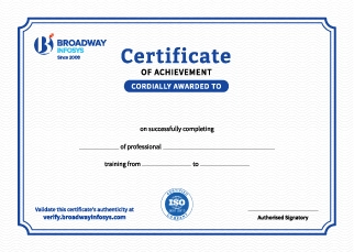
Earn a High Value Industry Certificate
Add this credential to your LinkedIn profile, resume, or CV to stand out to recruiters.
Already earned a certificate?
Verify it here
Frequently Asked Questions
No prior professional GIS experience is required. A basic understanding of computers and an interest in maps, geography, data, or spatial technology is recommended, allowing beginners and learners from technical or non-technical backgrounds to follow the training comfortably.
Yes. The training starts with GIS fundamentals and mapping concepts before moving into spatial data management, analysis, visualization, and practical GIS projects.
You will learn GIS concepts, spatial data, coordinate systems, map creation, georeferencing, digitization, spatial analysis, data visualization, and GIS-based project workflows.
Yes. You will learn how to work with vector data such as points, lines, and polygons as well as raster data, including how these datasets are used for mapping and spatial analysis.
Yes. You will learn about coordinate reference systems (CRS), projections, GPS coordinates, georeferencing, and spatial data accuracy, which are essential for creating reliable GIS maps.
Yes. You will learn techniques such as buffering, overlay analysis, spatial queries, proximity analysis, and other GIS analytical methods to extract insights from geographic data.
Yes. The training introduces remote sensing concepts, satellite imagery, image interpretation, and the use of spatial imagery for mapping and analysis, where included in the course curriculum.
Yes. You will learn how GPS and geospatial data can be collected, managed, visualized, and integrated into GIS workflows.
Yes. You will explore how AI and Machine Learning can support GIS, including spatial analysis, image classification, pattern recognition, automated mapping, and geospatial data interpretation.
Yes. GIS is widely used for urban planning, land-use analysis, infrastructure mapping, environmental monitoring, disaster management, agriculture, transportation, and resource management.
Yes. The training emphasizes hands-on learning through mapping exercises, spatial analysis, geospatial datasets, visualization, and real-world GIS project scenarios.
You will be able to create and manage digital maps, work with spatial datasets, perform GIS analysis, visualize geographic information, and apply GIS techniques to real-world spatial problems.
The training can help you pursue roles such as GIS Analyst, GIS Technician, GIS Specialist, Mapping Technician, Geospatial Analyst, and other GIS-related positions.
You’ll receive hands-on guidance from trainers throughout the training, including support with GIS tools, spatial datasets, mapping, analysis, practical exercises, and projects.
Yes. Depending on your requirements, you can discuss suitable schedules with the training team. One-to-one training and group-based learning options may also be available.
Our course is available in hybrid training mode. You can attend classes in person or join online, whichever works best for you. If you cannot attend in person on a particular day, you can simply join the class online instead.
The course pricing varies depending on the subject and level. For detailed information on the course price, please contact us directly: +977-9841002000 / +977-1-4111849. Our team will be happy to guide you or send us an email at [email protected].
Our syllabus outlines are only the headlines of the major modules. To ensure a complete understanding of the course, we offer free counseling. Also, if you have specific modules in mind, you can customize the course. Send your inquiry today!
Lesson 1: Using and making maps
- Opening and saving a map document
- Working with map layers
- Navigating in a map document
- Measuring distances
- Working with feature attributes
- Selecting features
- Changing selection options
- Working with attribute tables
- Working with attribute tables
- Labeling features
- Creating point and polygon maps using qualitative attributes
- Creating point and polygon maps using quantitative attributes
- Creating custom classes for a map
- Creating custom colors for a map
- Creating normalized and density maps
- Creating dot density maps
- Creating fishnet maps
- Creating group layers and layer packages
- Building an interactive GIS
- Creating map layouts
- Reusing a custom map layout
- Creating a custom map template with two maps
- Adding a report to a layout
- Adding a graph to a layout
- Building a map animation
- Using ArcGIS Online
Lesson 2: Working with spatial data
- Building a file geodatabase
- Using ArcCatalog utilities
- Modifying an attribute table
- Joining tables
- Creating centroid coordinates in a table
- Aggregating data
- Examining metadata
- Working with world map projections
- Working with US map projections
- Working with rectangular coordinate systems
- Learning about vector data formats
- Exploring raster basemaps from Esri web services
- Downloading raster maps from the USGS
- Extracting features for a study area
- Clipping features
- Dissolving features
- Merging features
- Intersecting layers
- Unioning layers
- Automating geoprocessing using ModelBuilder
- Digitizing polygon features
- Digitizing line features
- Digitizing point features
- Using advanced editing tools
- Spatially adjusting features
- Geocoding data by ZIP Code
- Geocoding data by street address
- Correcting source addresses using interactive rematch
- Correcting street reference layer addresses
- Using an alias table
Lesson 3: Analyzing spatial data
- Buffering points for proximity analysis
- Conducting a site suitability analysis
- Using multiple ring buffers for calibrating a gravity model
- Creating a 3D scene
- Creating a TIN from contours
- Draping features onto a TIN
- Navigating scenes
- Creating an animation
- Using 3D effects
- Using 3D symbols
- Editing 3D objects
- Using 3D Analyst for landform analysis
- Exploring ArcGlobe
- Processing raster map layers
- Creating a hillshade raster layer
- Making a kernel density map
- Extracting raster value points
- Conducting a raster-based site suitability study
- Solving the “traveling salesperson” problem
- Building a TIGER-based network dataset
- Creating travel polygons
- Locating facilities
- Routing vehicles from depots to demand points

QA Training
Stata Training in Nepal

SPSS Training
Upcoming Classes (6)
Why GIS Training?
Essential Mapping Skills: Learn GIS to collect, manage, analyze, and visualize geographic and spatial data.
Spatial Data Analysis: Understand how to work with maps, locations, coordinates, and geographic datasets for informed decision-making.
Industry Applications: Apply GIS skills in urban planning, civil engineering, surveying, environmental studies, and other fields.
Practical Projects: Work with real-world spatial data and mapping projects to build hands-on experience.
Industry-Relevant Tools: Learn to use GIS software and techniques commonly applied in professional mapping and analysis.
Career-Ready Skills: Build practical knowledge for opportunities in GIS, surveying, mapping, planning, and spatial data analysis.
Modern Training Labs: Learn in well-equipped labs with access to the latest technology and tools.
Quick Inquiry
Choose class schedule(s)
-
11 Oct 2026
-
26 Oct 2026
-
01 Nov 2026
-
17 Nov 2026
-
22 Nov 2026
-
23 Nov 2026